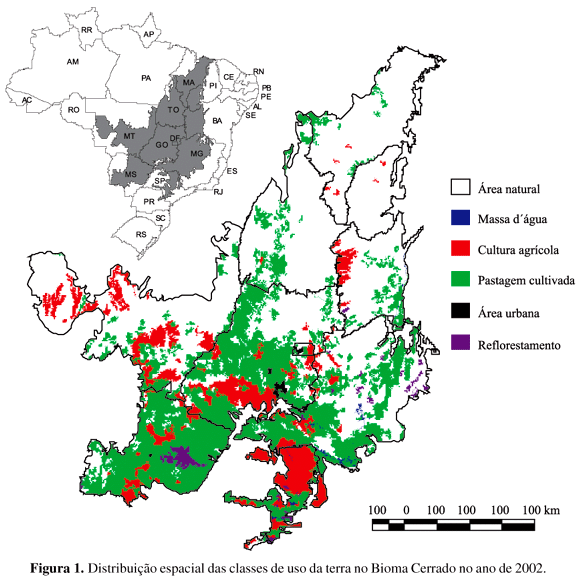
The objective of this work was to map the land use in Cerrado at the 1:250,000 scale. The following classes of land use were considered: croplands, planted pasturelands, reforestations, urban settlements and mining areas. The methodological approach involved Landsat image segmentation, visual classification of the segments and analysis of the global accuracy of the final map. Approximately 39.5% of Cerrado presented some type of land use activity. Planted pasturelands and croplands were the dominant classes, with 26.5 and 10.5%, respectively.
Landsat; PROBIO; image segmentation; remote sensing


