Ponte do Futuro: investigating socio-spatial impacts of a project connecting municipalities north of João Pessoa, Brazil
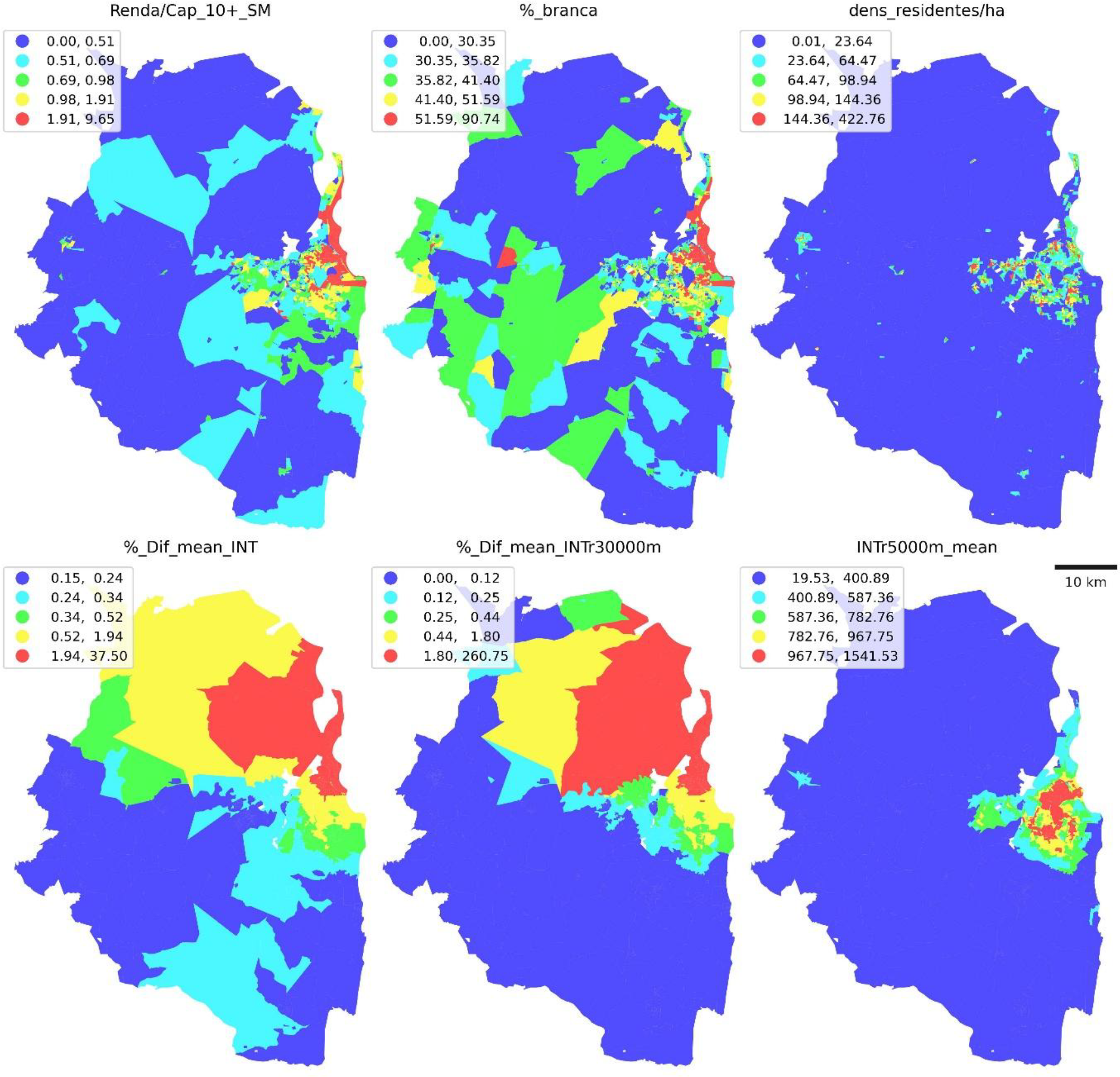
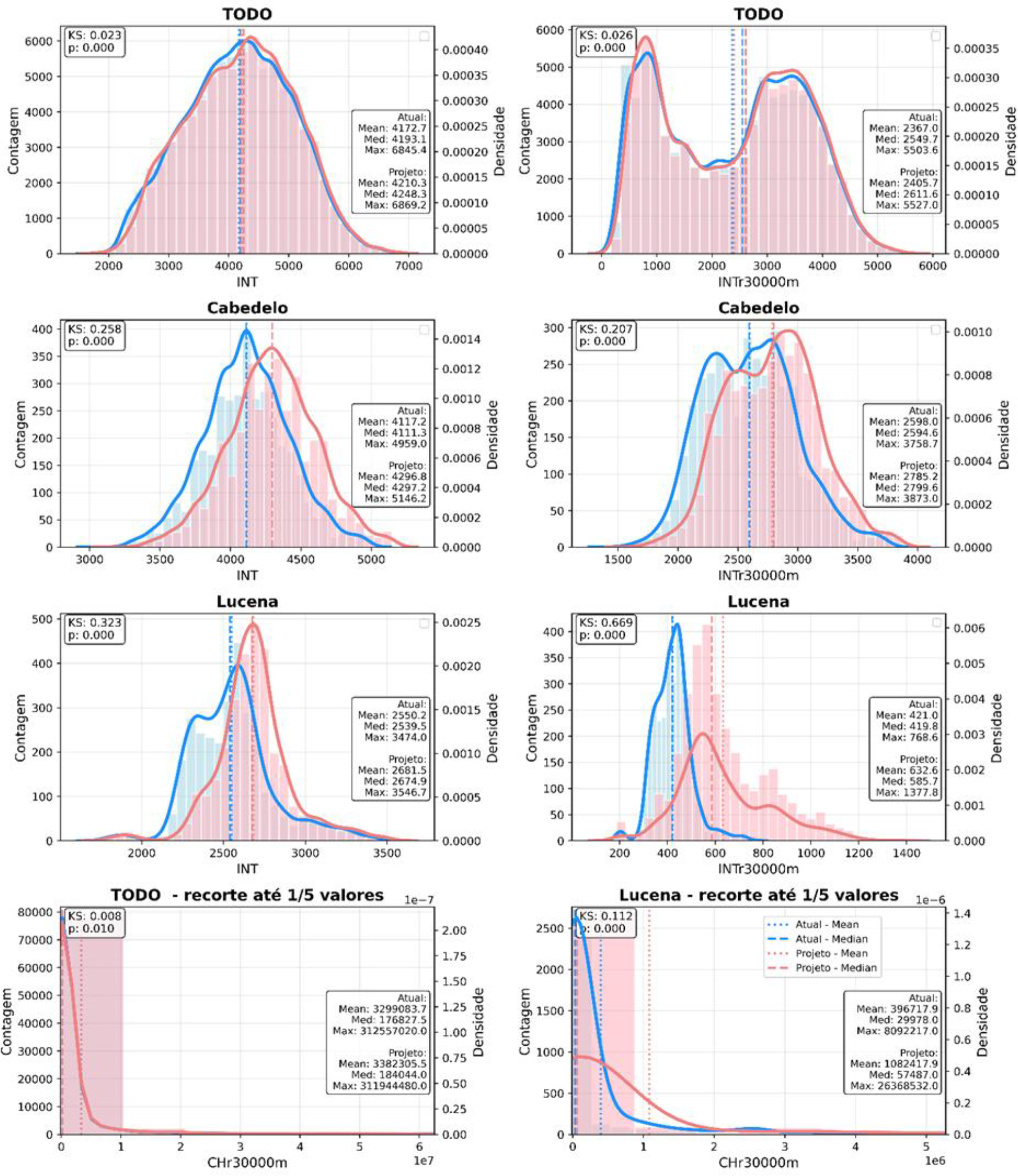
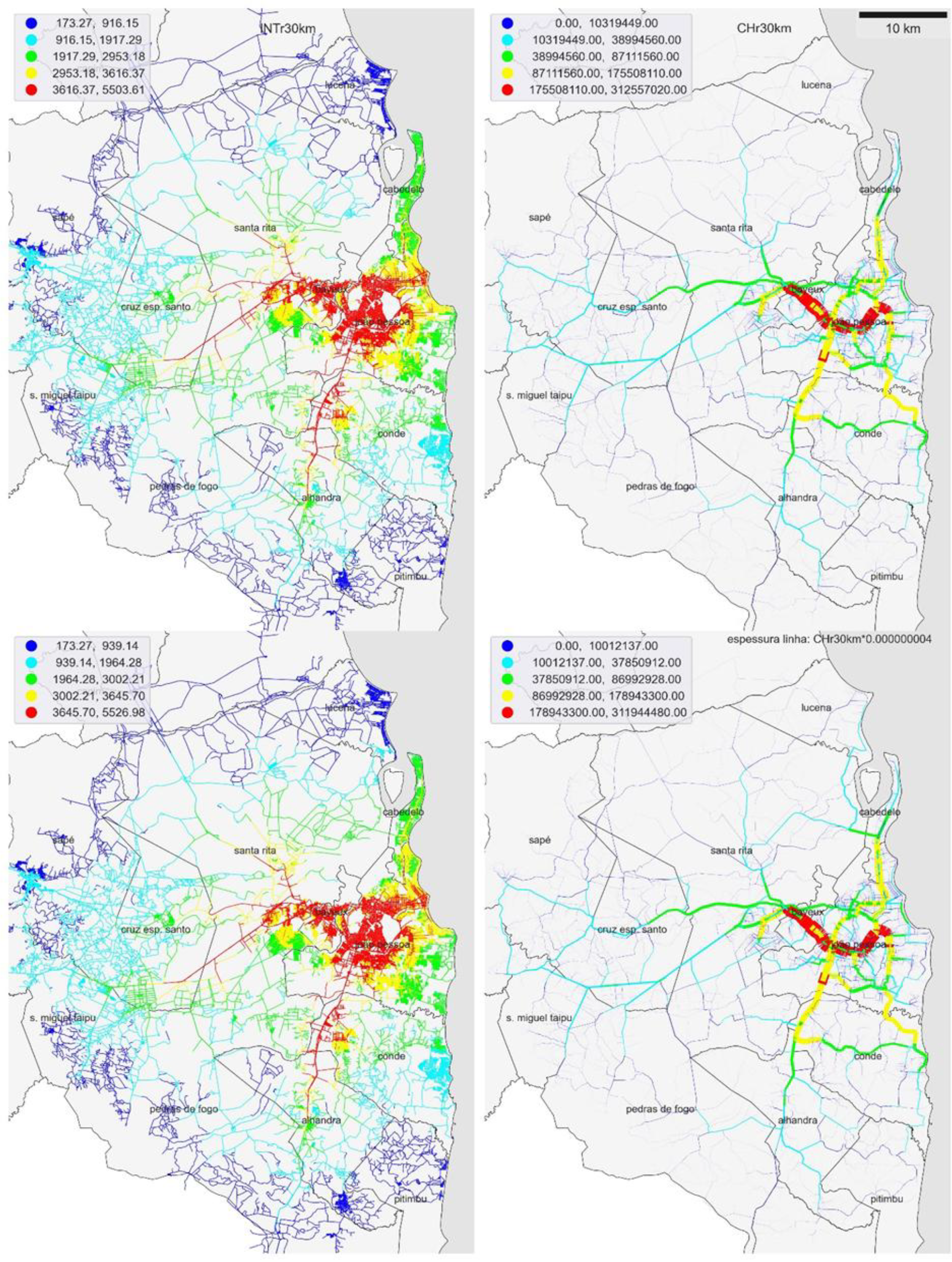
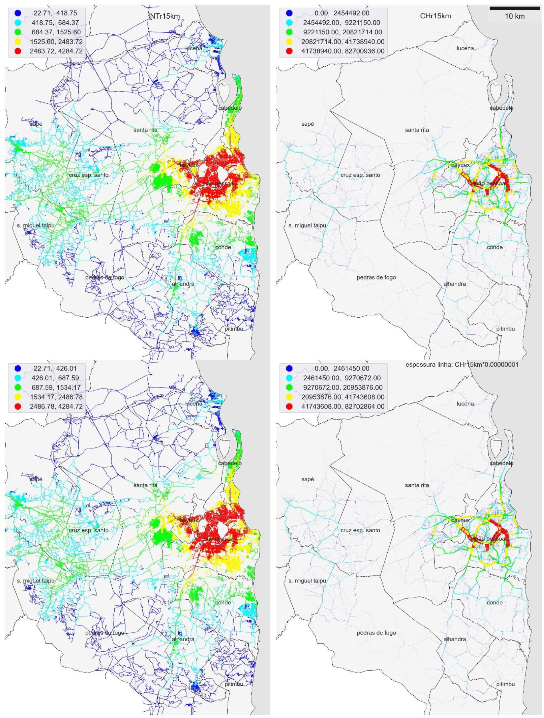
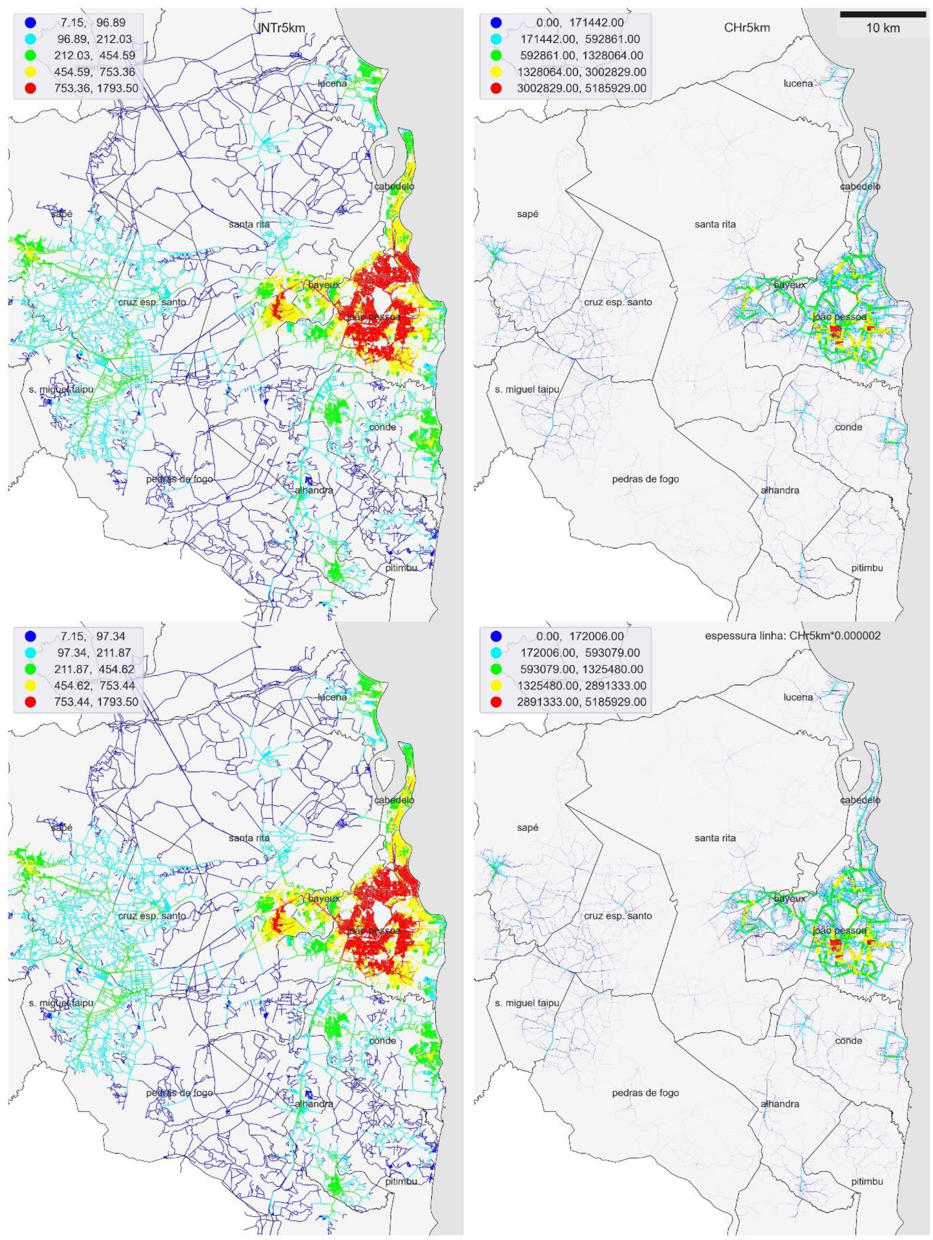
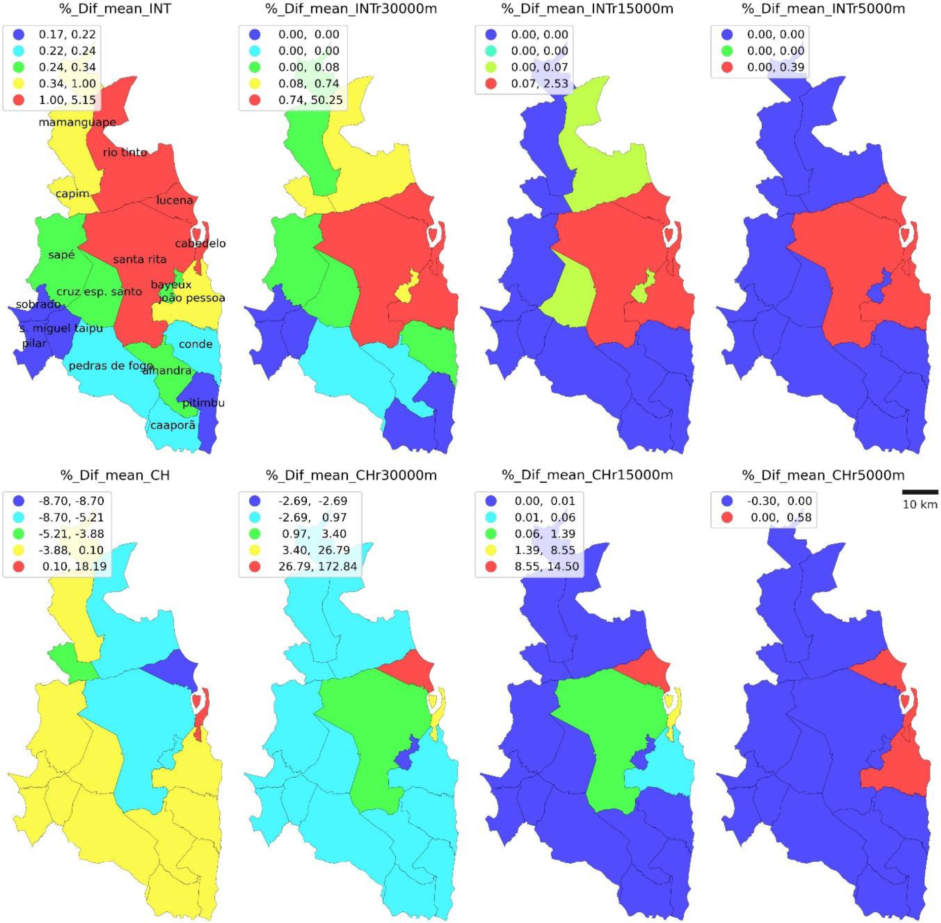
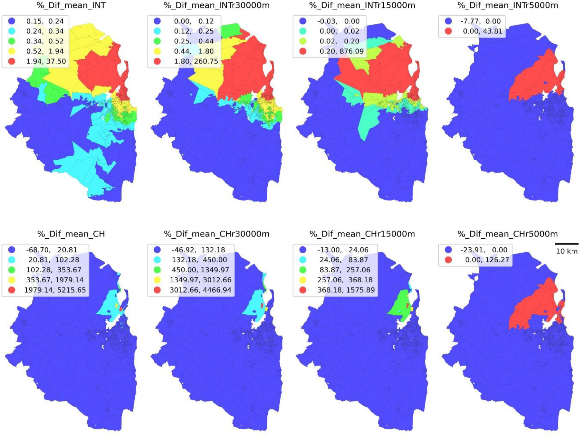
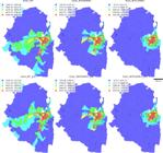
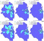
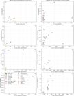
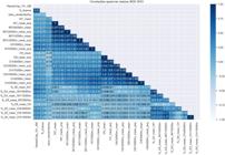
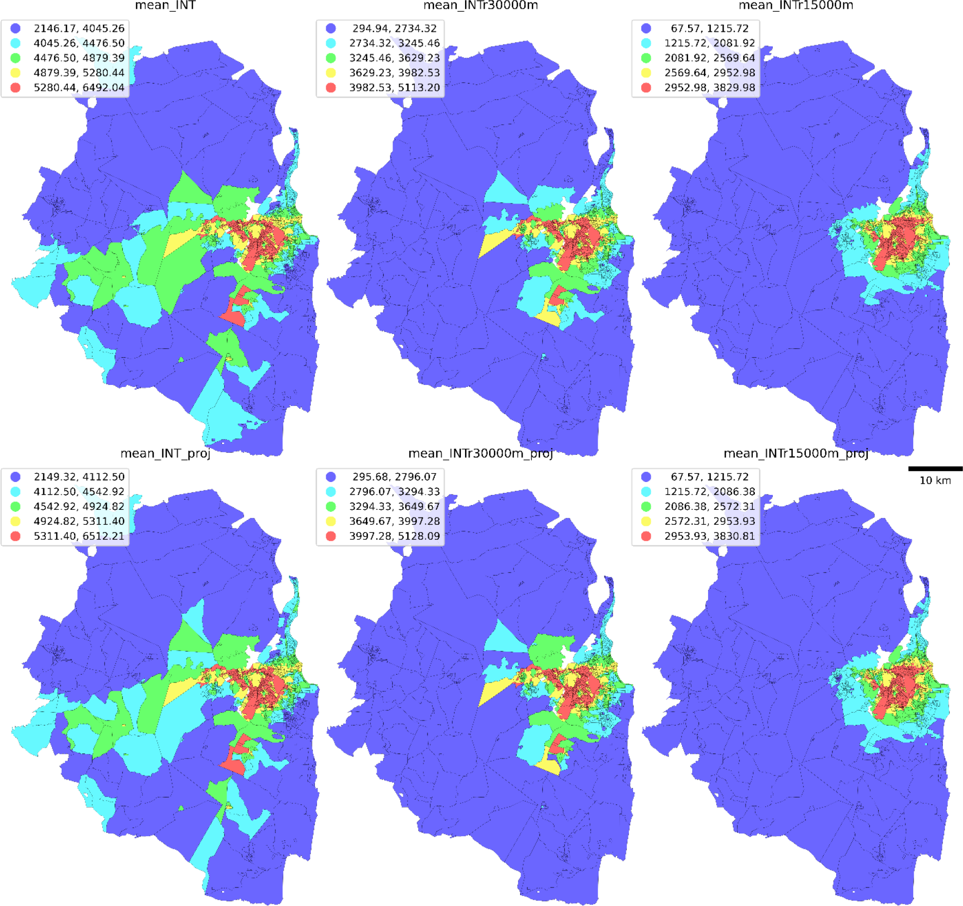
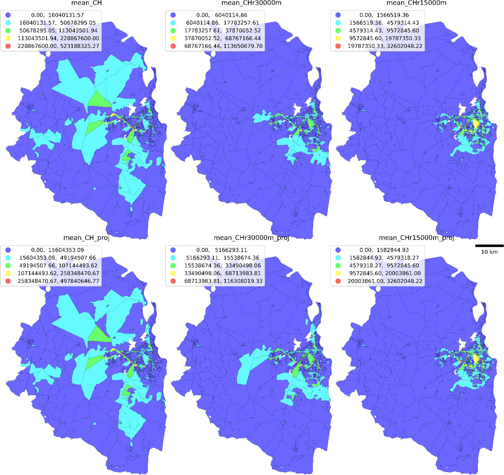
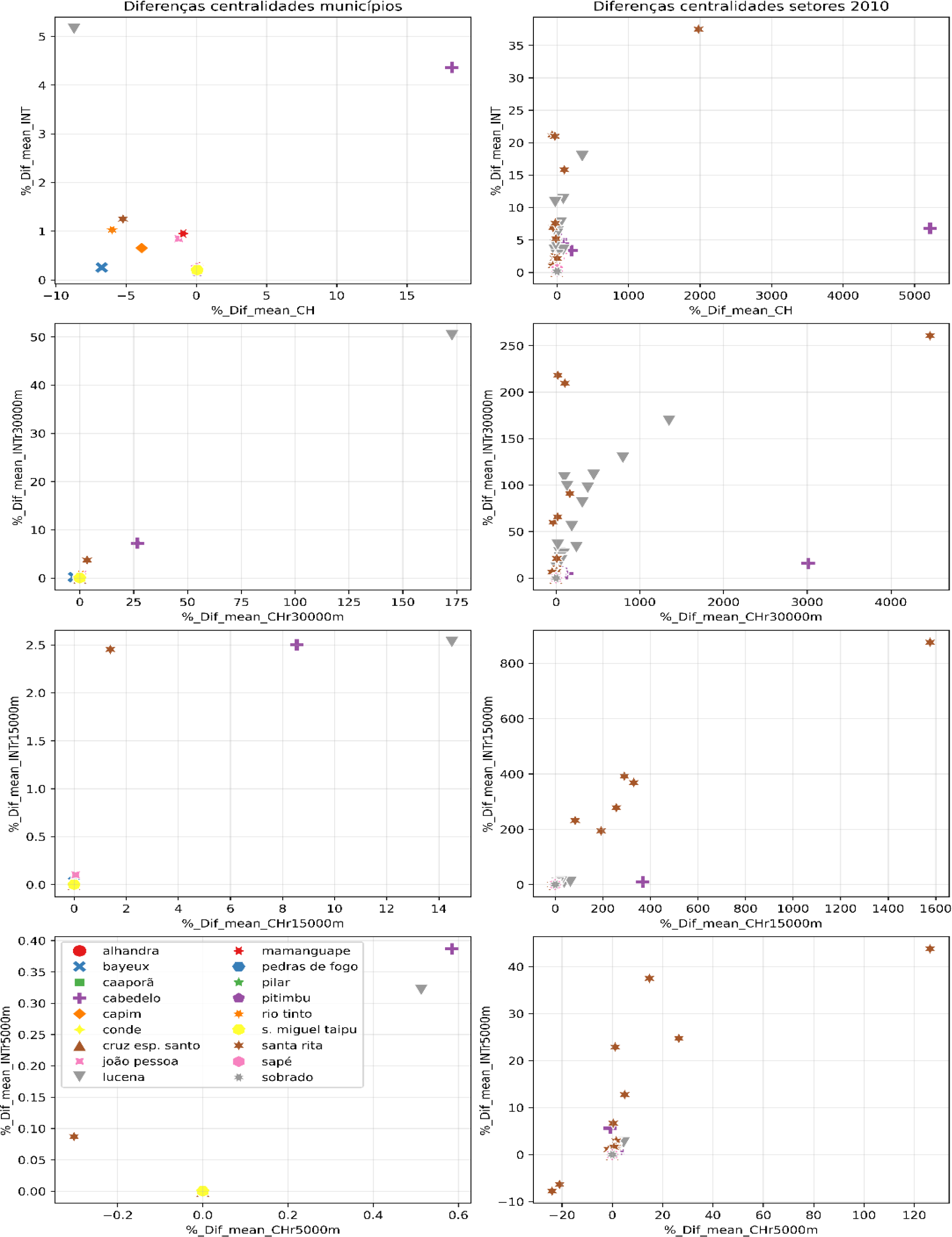
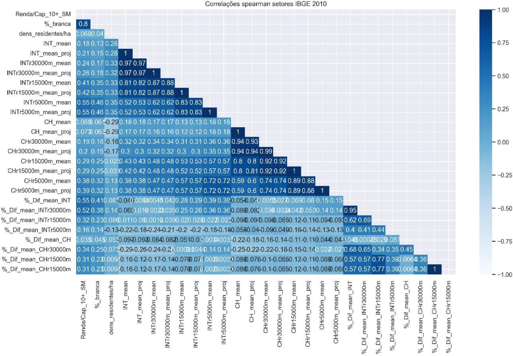
Road network models’ studies simulate movement and interventions impacts in settlements. A road construction work in its initial phase between municipalities north of João Pessoa has advertised benefits, however informations are little detailed. This paper investigates project centralities changes at different areas, testing the hypothesis that centrality gains concentrate on more economically privileged areas. The road network approximating the Greater João Pessoa scale was analysed, in the current and proposed scenarios. Space Syntax Centralities of potential movements to places (integration) and between places (choice) were compared for municipalities and for census sectors, and related to sociodemographic data. Results indicate gains of integration and a reduction in maximum choice values over wider radii, relieving roads that intermediate many routes, and point to more changes in certain municipalities, as Lucena. Integration gains were moderately related to income, reinforcing a privileged area near João Pessoa northern coast.
Keywords
Road Networks; Space Syntax; Urban Design; Urban Planning; Greater João Pessoa.
 Thumbnail
 Thumbnail
 Thumbnail
 Thumbnail
 Thumbnail
 Thumbnail
 Thumbnail
 Thumbnail
 Thumbnail
 Thumbnail
 Thumbnail
 Thumbnail
 Thumbnail
 Thumbnail
 Thumbnail
 Thumbnail
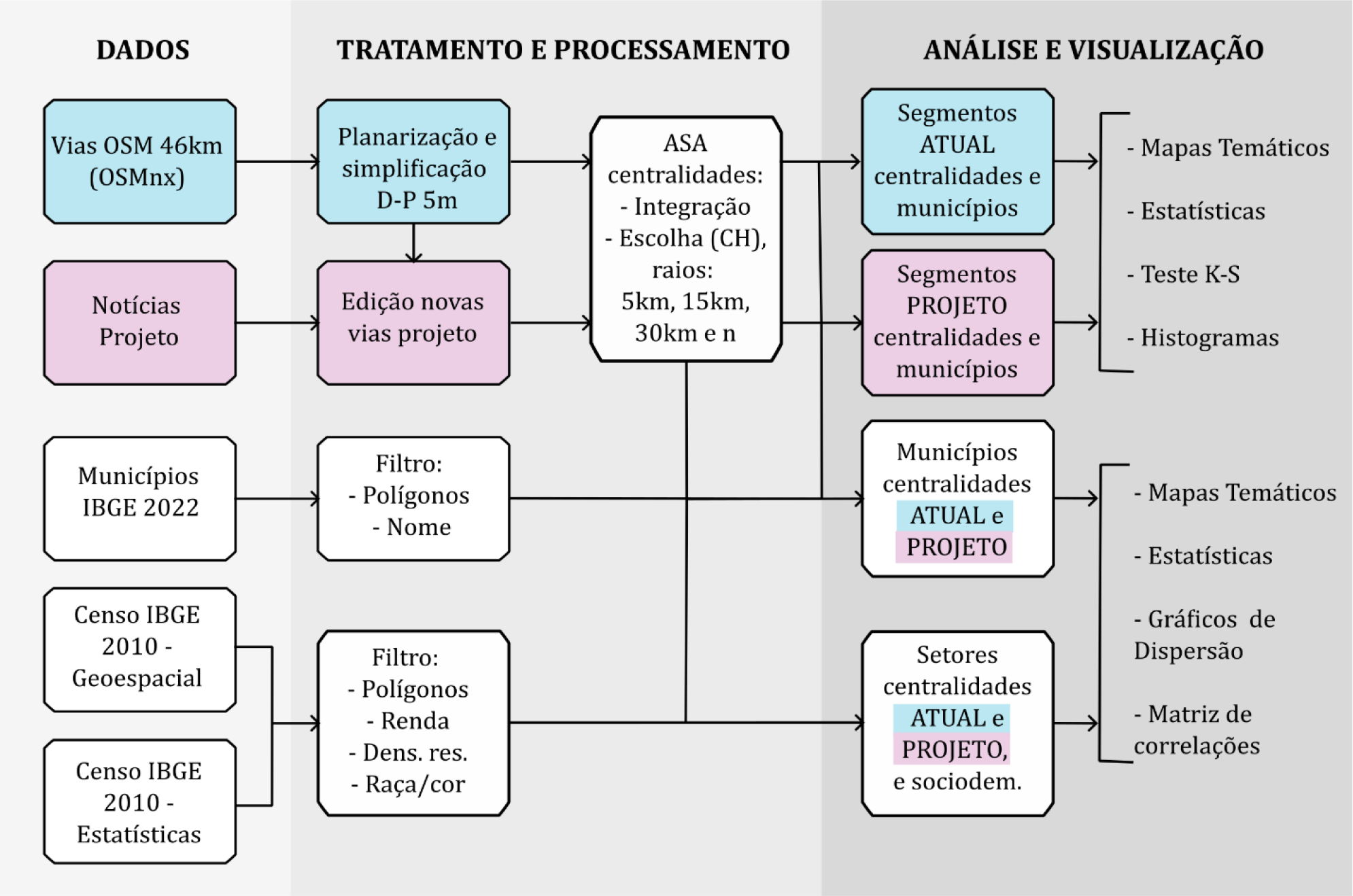
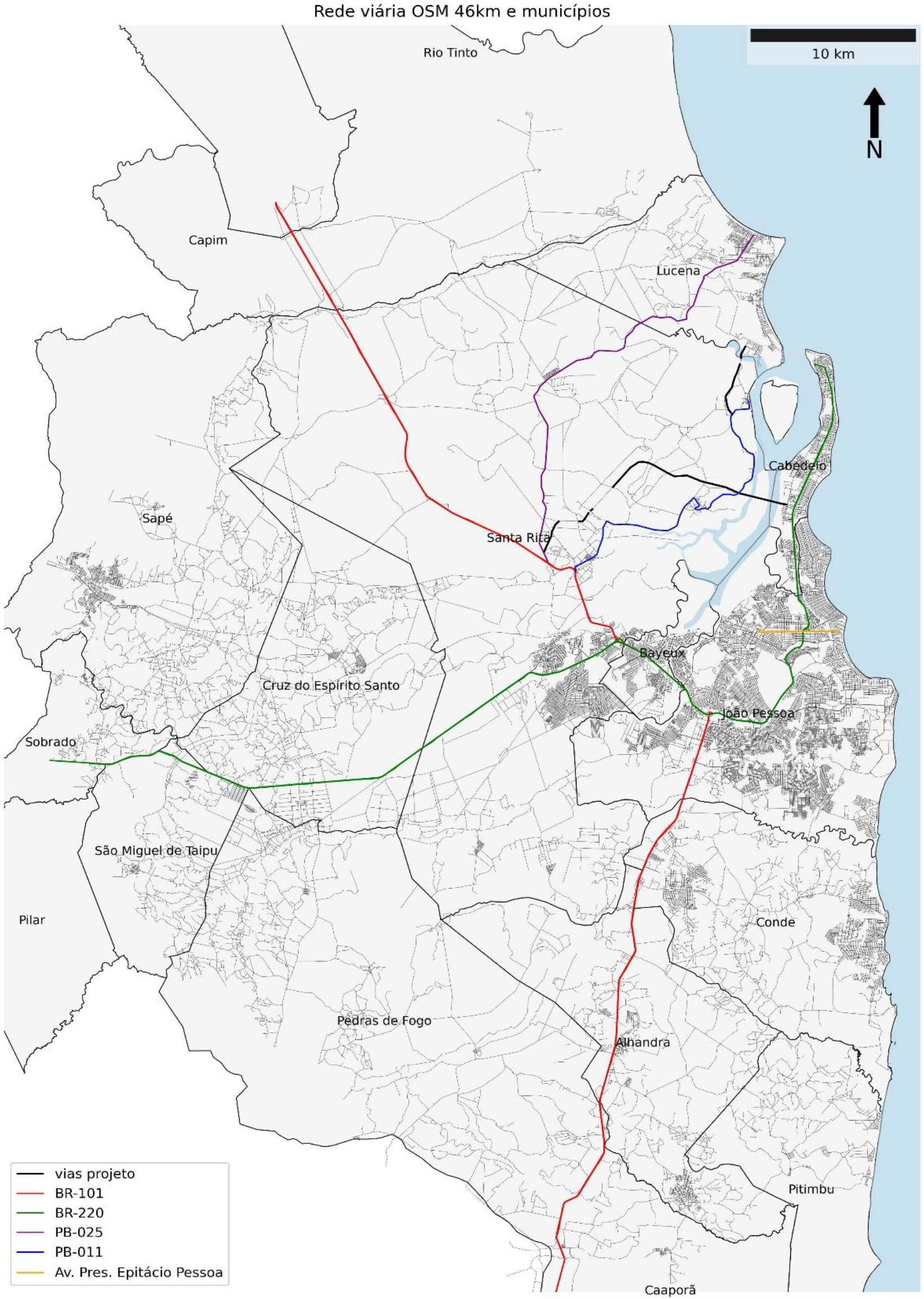
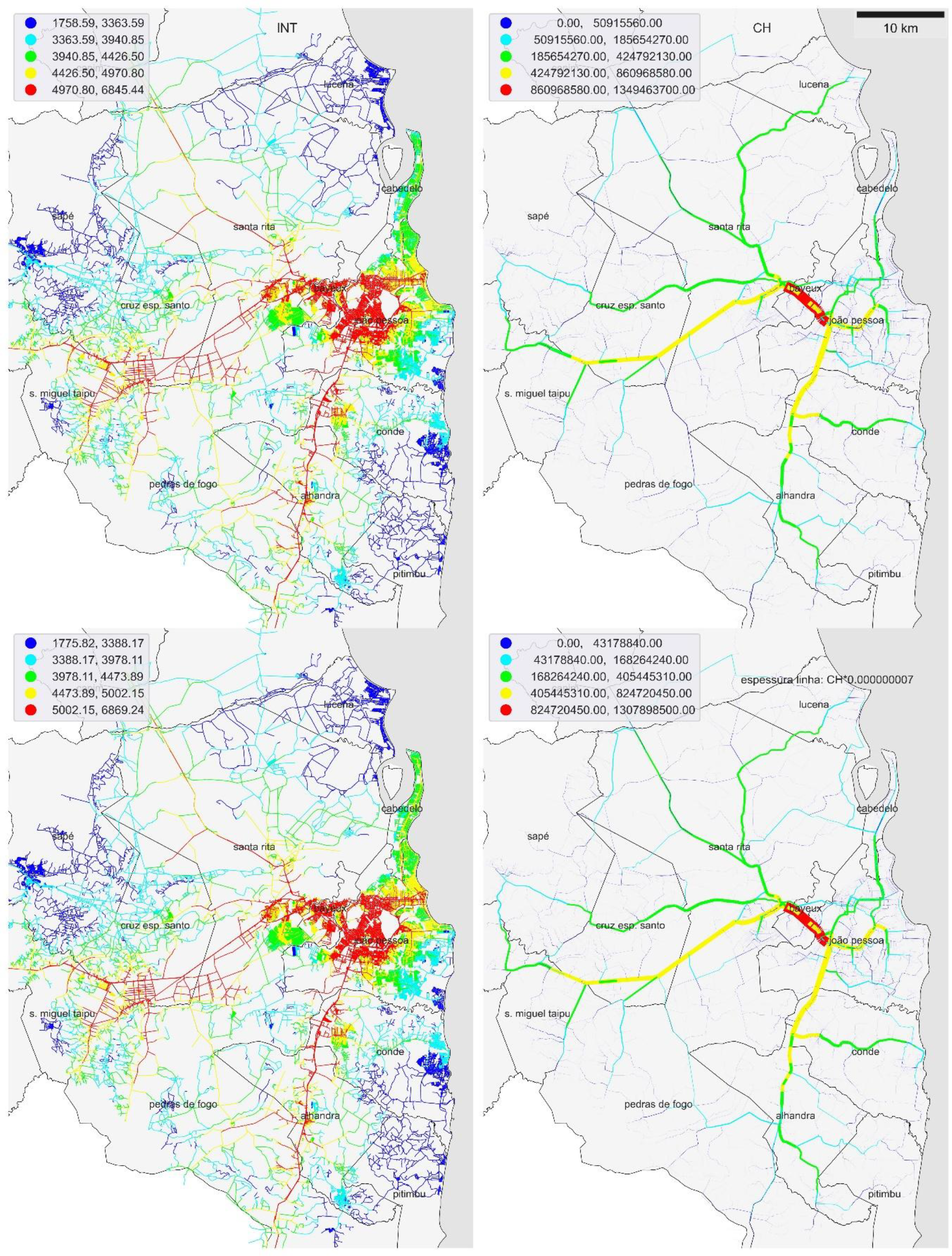
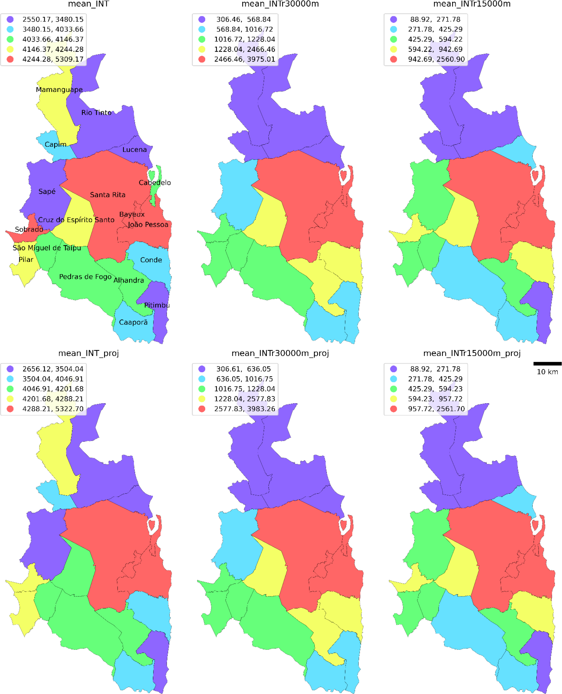
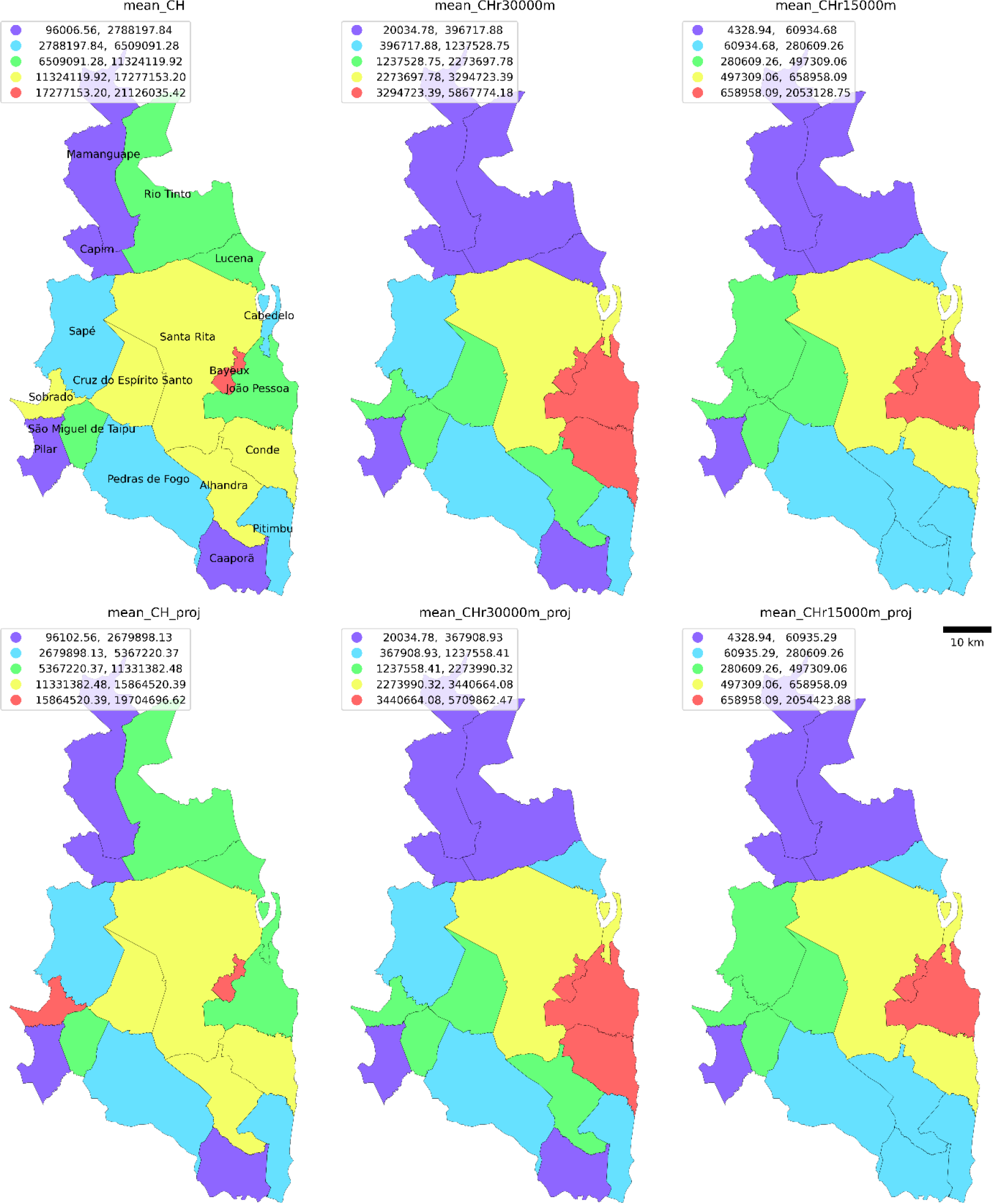
 Fonte: autoras (2024).