
 Methodological Proposal for the Calculation and Spatial Analysis of an Intra-Urban Vulnerability Index: Case of Três Pontas, Minas Gerais
The scarcity of detailed intra-urban data in Brazil poses a challenge for creating vulnerability indices at the census tract level, which are crucial tools for planning and equitable resource allocation. This study aimed to propose and apply a methodology for developing an Intra-Urban Vulnerability Index (IVI) using data from the 2010 Demographic Census (IBGE). The methodology was tested in the municipality of Três Pontas, Minas Gerais, covering 88 urban census tracts. Fourteen socioeconomic and infrastructure indicators were selected and subjected to Principal Component Analysis (PCA) for the index construction. PCA yielded two principal components that together explained 71.80% of the total variance of the indicators: the Intra-Urban Social Development Index (PC1) and the Intra-Urban Deprivation of Resources and Services Index (PC2). Subsequent spatial analysis in a GIS environment (QGIS) allowed for the identification and mapping of vulnerable areas. Notably, the overlap of areas with low social development (low PC1) and high deprivation of resources and services (high PC2) revealed that 13.31% of the urban population resides in conditions of critical vulnerability. The proposed methodology proved to be an effective tool for diagnosing intra-urban vulnerability, with a potential for replication in other Brazilian municipalities with similar characteristics and data deficiencies.
Keywords:
Principal Component Analysis; Area-based indices; Socioeconomic stratification
 Thumbnail
 Thumbnail
 Thumbnail
 Thumbnail
 Thumbnail
 Thumbnail
 Thumbnail
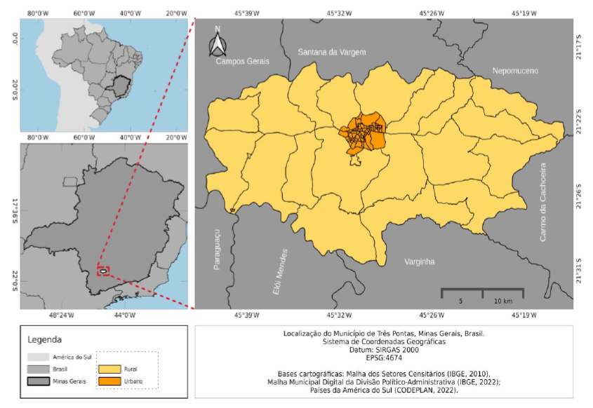 Fonte: Elaborado pelo autor.
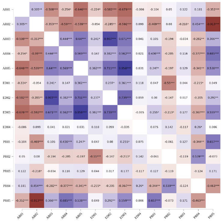 Fonte: Elaborado pelo autor.
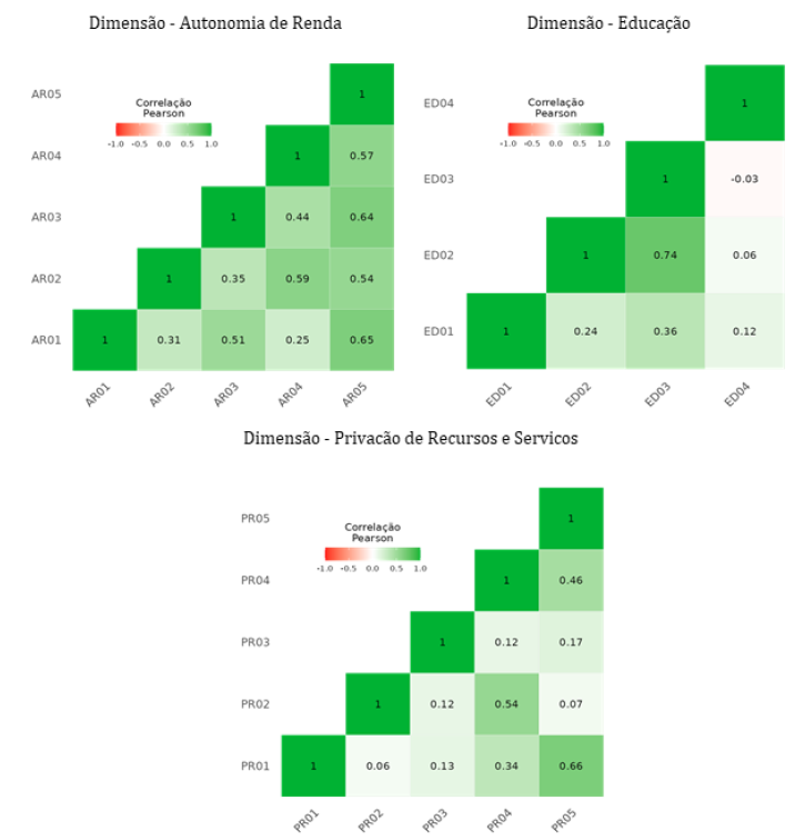 Fonte: Elaborado pelo autor.
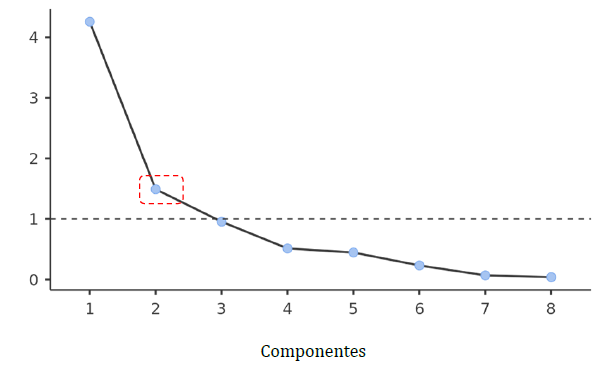 Fonte: Elaborado pelo autor.
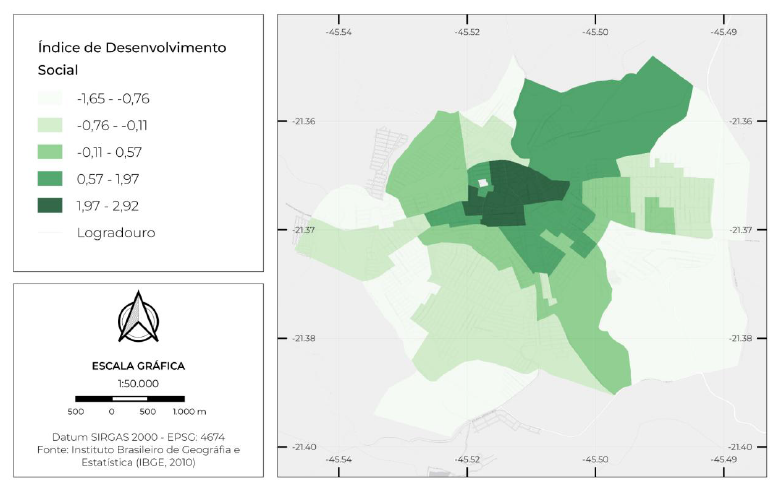 Fonte: elaborado pelo autor.
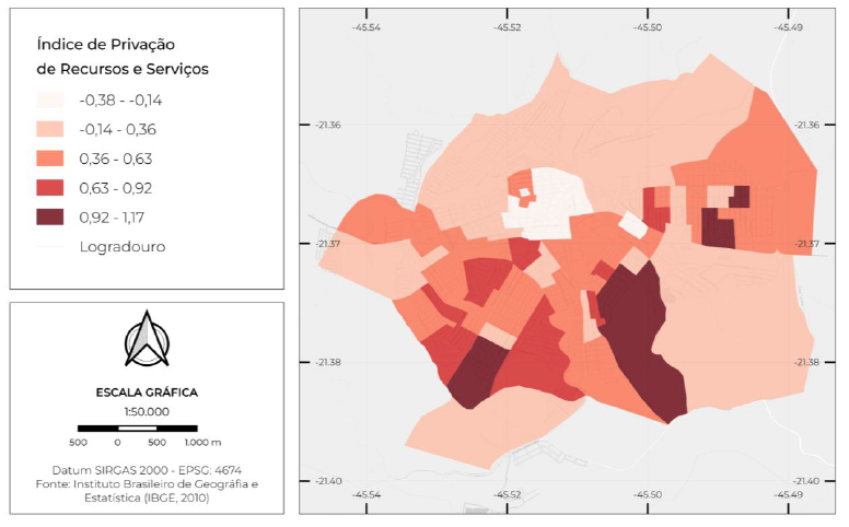 Fonte: Autores (2026).
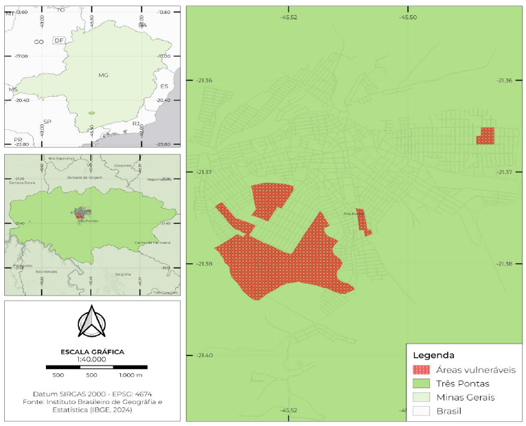 Fonte: elaborado pelo autor.