Abstract
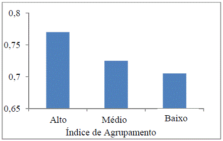
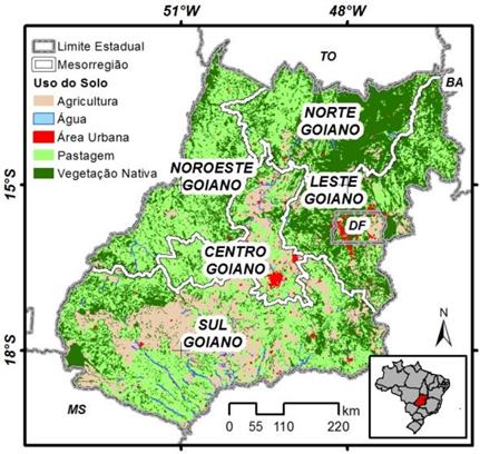
This study presents the results of the spatial clustering of the 246 towns of the State of Goiás, Brazil, considering basic sanitation data, human development index and land use. Monthly data related to E. coli, turbidity and apparent color from 140 local sources between 2005 and 2009 were also analyzed and compared with the vegetation cover and precipitation. For the preparation of spatial clustering analysis, the Getis-Ord index was used and it was applied to sanitation, Human Development Index (HDI) and vegetation cover index (Landsat 7 ETM+ images acquired in 2002). It was observed that there is a strong correlation (p<0.05) between areas that have higher rates of sanitation with the regions that have the highest HDI levels, and an inverse relationship with the occurrence of remaining vegetation cover index. There was a change in water quality among towns that have greater intervention in land use, especially in the North of Goiás, Brazil, which has the largest remaining vegetation areas and showed better values for apparent color, turbidity and E. coli than the other municipalities. In addition, concentrations of these parameters increased with rainfall, which in the State of Goiás, Brazil, occurs primarily between November and April.
Keywords:
environmental degradation; riparian vegetation; water resources

 Thumbnail
 Thumbnail
 Thumbnail
 Thumbnail
 Thumbnail
 Thumbnail
 Thumbnail
 Thumbnail
 Thumbnail
 Thumbnail


