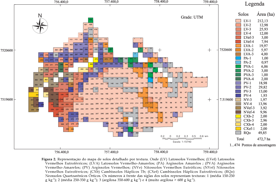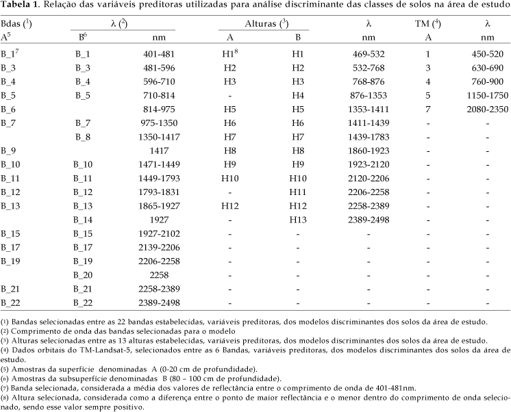
A huge amount of soil samples would be necessary to determine with precision the limits of soil units. Techniques that would help on soil surveys such as the remote sensing ones have been proved to be of great value. The objective of this work was to evaluate the possibility of differentiating soils using spectral data from laboratory and satellite sensors. A study area with soils originated from two different parent materials, sandstone with loamy cement and basalt, was selected. A grid (100 m x 100 m) was used, totalizing 473 sampling points in the depths 0-20 cm (superficial, A) and 80-100 cm (subsuperficial, B). A soil map of the area with 28 mapping units was generated. The laboratory spectra (450 to 2500 nm) were obtained with an IRIS spectroradiometer. The orbital reflectance was obtained by image processing and overlaying of the TM-Landsat-5 bands in the sampling points. Discriminant equations were generated by statistical treatment with the SAS software. From the seventy initial variables from laboratory data, fifty six were selected to generate the models of the equations; for orbital data, six of the seven TM bands were selected. The equations were tested and the confusion matrix were obtained. Discriminant equations from laboratory data presented 81% success and the equations with orbital data 40%, however, for the satellite data it was verified a good efficiency for separating soils from different parent materials.
Discriminant equations; reflectance; remote sensing; soil mapping