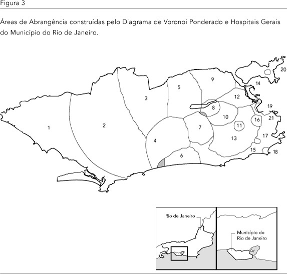
One of the most important pieces of information for health resources planning is the definition of catchment areas for health units. Voronoi Diagrams are a potential technique for this purpose. They are polygons with the property whereby adjacent polygons have their borders located within the same distance of the respective generator points. One possible adjustment to the catchment areas thus defined is the use of weighted Voronoi Diagrams, which result in an improved representation of a health unit's actual capacity. In this study, the 21 public general hospitals in the city of Rio de Janeiro, Brazil, were used as generator points for Voronoi Diagrams. Non-weighted Voronoi Diagrams were initially implemented and then used as the basis for obtaining weighted Voronoi Diagrams, using as weights the annual admission rates estimated for each unit. In the classic Voronoi Diagram case, some catchment areas had similar sizes, although their respective health units had different characteristics. In the weighted case the areas were modified in a way that appeared closer to the actual functioning of the units. The method appeared simple to implement, used easy-to-access data, and did not rely on geopolitical considerations such as existing administrative areas. It thus provided a more realistic picture of a unit's capacity to support basic health programs.
Accessibility; Voronoi Diagrams; Health Planning