ABSTRACT
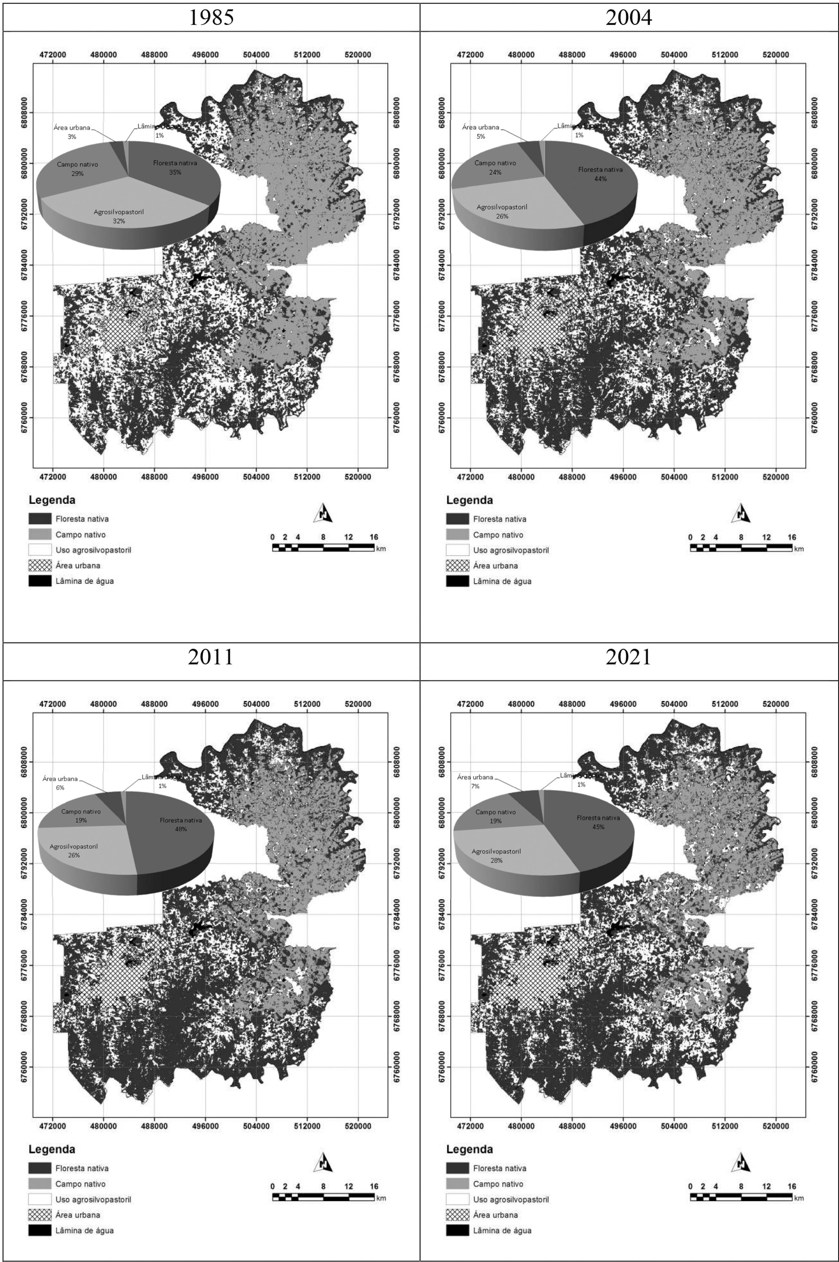
The conversion of natural areas for agricultural production and the real estate exploitation has led to a considerable reduction of forest areas in the Atlantic Forest in the last century. Official data indicate a reduction of 71% in this biome's forests, what is a worrying indicator, since it is worldwide recognized as the fifth of the 34 hot spots of the planet and with high biodiversity so as high degree of endemism. In this context, the aim of this study was to evaluate the changes in the forest fragmentation of the Atlantic forest in the city of Caxias do Sul-RS, calibrating a spatial dynamic model for this process and simulating a scenario for the year of 2021. To achieve the proposed goal it was used a time series of Landsat 5 satellite images from the years of 1985, 2004 and 2011, with topography and soil information data. The results indicated an increase of native forest from 1985 to 2011 (increase of 36%) and to the 2021 simulated scenario (20% of forest areas). This increase in forest cover in the evaluated area is possibly associated with the rural exodus, more rigorous enforcement of environmental laws and strict enforcement by the environmental agency. This presents relevant information for decision making in relation to the management and monitoring of forest resources.
Remote Sensing; Cellular automata; Fragmentation


