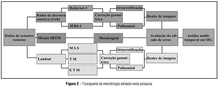
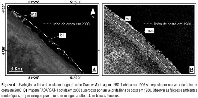
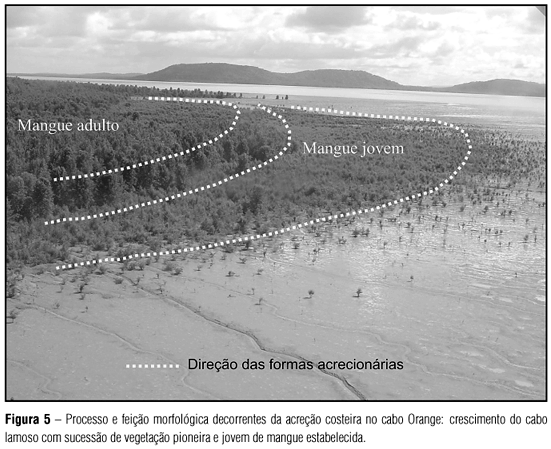
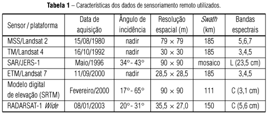
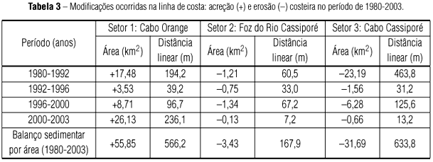
The Cassiporé and Orange mudcapes in the Northern of Brazil constitute a dynamic environment influenced by the Amazon river, where the shoreline changes are subjected to severe processes of progradation and erosion. Optical and microwaves remote sensed images were acquired from 1980 to 2003, and analyzed in a Geographic Information System (GIS), allowing the identification and quantification of prograding and retrograding areas along the shoreline. During this period, the largest erosion rates had occurred next to the Cassiporé Cape, with mean retreat of 27.5 m of linear distance and erosion of 1.37 km² of mangrove area per year. On the other hand, the largest rates of sediment deposition had occurred in the Orange Cape, where the coastal prograded 24.6 m per year, adding 55.86 km² of mangrove area to shoreline in the last 23 years. The progradation mechanisms have determined an accretion in the mangrove vegetation of 50.8% throughout the last three decades. A sedimentary balance carried out in the study area showed that constructive processes (61.3%) are dominant over erosive processes (38.7%).
shoreline changes; mangrove; mud cape; Amapá; Amazon


